Norway · Hairpins · Scenic · Bucket list
Trollstigen
County Road 63 · The Trolls' Road
- Length
- 55 km34 miles
- High point
- 852 m2,795 ft
- Driving time
- 1.5 hours
- Season
- Late May to October
- Toll
- Free
- Country
- Norway
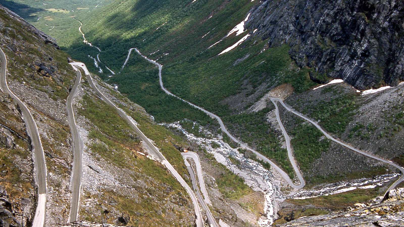
Trollstigen climbs out of the Isterdalen valley on eleven hairpins at a gradient of around 10 per cent, crossing the Stigfossen waterfall on a stone bridge halfway up. The road opened in 1936 and much of it is still single-track width with passing places. A viewing platform cantilevered over the drop at the top looks straight back down the whole thing.
The drive
Drive it south from Åndalsnes so that you are climbing. The hairpins are tight and steep and you will meet coaches, so progress depends on traffic. From the plateau, county road 63 continues south over the mountain to Valldal, and with a ferry crossing and the Eagle Road you can go on to Geiranger.
The full Geiranger to Trollstigen national tourist route is about 104 km and takes most of a day with stops.
In your Lotus
An Elise or Exige is narrow, which is a real advantage on a road where campervans meet on the bends. Low-speed cooling is worth watching on a hot day in a queue, particularly on S1 cars with original radiators.
Watch out for
- Rockfall has caused extended closures in recent seasons. Check the road status before committing to the route.
- The road is closed all winter, typically from October or November to late May.
- The surface is wet from waterfall spray near the Stigfossen bridge.