Spain · Hairpins · Coastal · Dead end
Sa Calobra
MA-2141 · Coll dels Reis, Mallorca
- Length
- 13 km8 miles
- High point
- 682 m2,238 ft
- Driving time
- 30 minutes each way
- Season
- Year-round (best October to May)
- Toll
- Free
- Country
- Spain
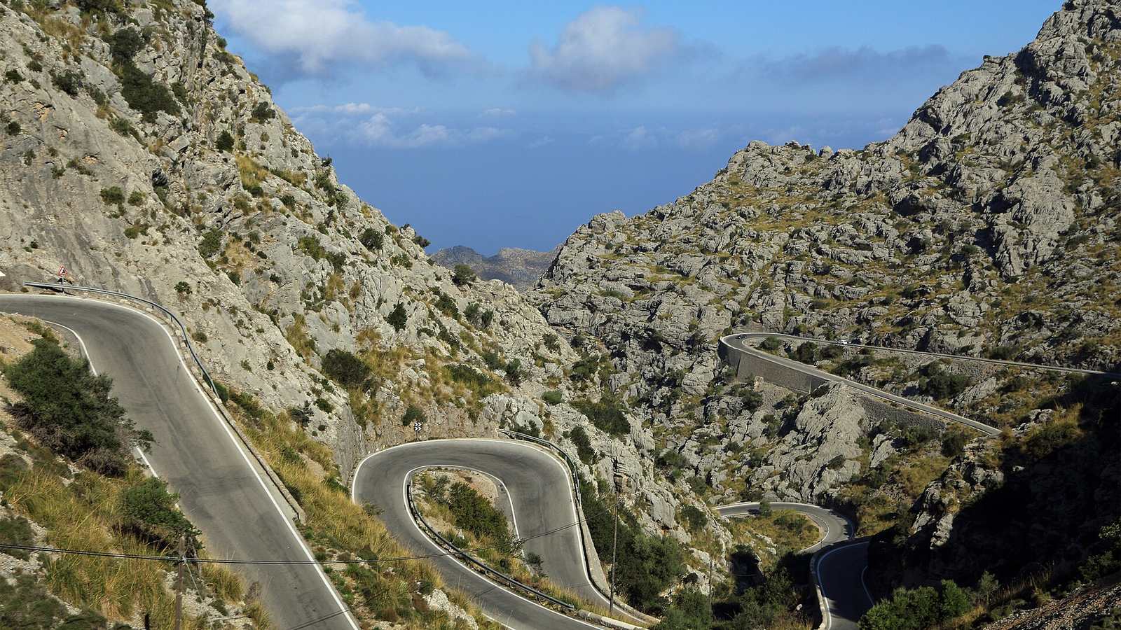
The road to Sa Calobra was designed in the 1930s by the engineer Antonio Parietti to reach a remote cove without tunnelling. It descends about 680 m in 13 km through dozens of bends, including the Nus de sa Corbata, the 'Tie Knot', where the road loops through 270 degrees and passes under itself.
The drive
It is a dead end, so you drive down and then drive back up. The descent is steep and technical with rock walls close to the road. The climb back is the fun part: you can see the next few hairpins stacked above you and pick your moments.
Reach it from the MA-10, the main road along the Serra de Tramuntana, which is itself one of the best drives in Spain. The section from Sóller past the Gorg Blau reservoir is especially good.
In your Lotus
Mallorca is a popular winter destination for European Lotus owners, with ferries from Barcelona and Valencia, and Sa Calobra is why. The scale suits the car perfectly. Timing is everything: go before 9 am or late in the afternoon, when the tour coaches have left.
Watch out for
- Coaches need the whole road on the hairpins and run in convoys mid-morning.
- Hundreds of cyclists climb it every day from February to May.
- Goats on the road, and rock fragments after rain.